Below are some of the Tours that the Ganaraska Freewheelers have developed for club members.
| LOCALTOUR (556 km) |
 |
||
|---|---|---|---|
| Port Hope, Presqu’ile, Campbellford and Prince Edward County (6 Days) | |||
| Day | Route | Distance | Comments |
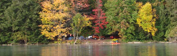
| Day 1 | Port Hope to Presqu’ile | 55 km | This portion follows the Waterfront Trail for most of the way and is relatively flat. Camping accommodations available at Presqu’ile Provincial Park. |
| Day 2 | Presqu’ile to Campbellford Directions |
60 km | Overnight camping accommodations available at Ferris Provincial Park in Campbellford. |
| Day 3 | Campbellford to Adolphustown Directions and Map |
114 km | Overnight camping accommodations available at UEL Heritage Centre and Park |
| Day 4 | Adolphustown to Consecon Directions |
105 km | Overnight camping accommodations available at Bayview Park |
| Day 5 | The Wine Tour “The Wobbly Tour” Map and Directions |
60 km | Visiting the wineries of Casa Dea Estates, Karlo Estates, Hillier Creek Estates, and The Grange of Prince Edward. |
| Day 6 | Consecon to Port Hope Directions |
75 km | Return trip. Relatively flat, easy riding! |
| ADIRONDACKS TOUR (845 km) |
 |
||
|---|---|---|---|
| Starts in Kingston, Canada and tours through the Adirondacks in New York State (9 Days) | |||
| Day | Route | Distance | Comments |
| Day 1 | Kingston to Grenville Park, Prescott renville Park to Glengarry Park
Map 1: Downtown Kingston |
104 km | Overnight camping at Grenville Park. |
| Day 2 | Map 2: Fort HenryG | 107 km | |
| Day 3 | Map 3: Treasure Island | 117 km | |
| Day 4 | Map 4: Willowbank | 98 km | |
| Day 5 | Map 5: Gananoque | 68 km | |
| Day 6 | Map 6: Ivy Lea/Rockport | 73 km | |
| Day 7 | Map 7: Mallorytown | 90 km | |
| Day 8 | Map 8: Brockville | 91 km | |
| Day 9 | Map 9:Brockville to Grenville Park (?) | 97 km | |
| COTTAGE COUNTRY TOUR (726 km) |
 |
||
|---|---|---|---|
| A wonderful tour through Southern Ontario’s Cottage Country. Start & finish in Port Hope (9 Days) | |||
| Day | Route | Distance | Comments |
| Day 1 | Port Hope to Presqu’ile Map 1:Port HopeMap 10: Brighton |
55 km | Overnight camping at Presqu’ile Provincial Park. |
| Day 2 | Map 2: Carr’s Marsh | 92 km | |
| Day 3 | Map 3: Cobourg | 74 km | |
| Day 4 | Map 4: Spicer/Brookside | 100 km | |
| Day 5 | Map 5: Grafton | 54 km | |
| Day 6 | Map 6: Wicklow | 66 km | |
| Day 7 | Map 7: Lakeport | 88 km | |
| Day 8 | Map 8: Colborne | 95 km | |
| Day 9 | Map 9: Spencer Point | 102 km | |
THREE RIVERS TOUR (662 km) |
 |
||
|---|---|---|---|
| A gorgeous, relatively flat route that follows the Rideau, Ottawa, and St. Lawrence Rivers (7 Days) | |||
| Day | Route | Distance | Comments |
| Day 1 | 83 km | ||
| Day 2 | 113 km | ||
| Day 3 | 73 km | ||
| Day 4 | 121 km | ||
| Day 5 | 108 km | ||
| Day 6 | 82 km | ||
| Day 7 | 82 km | ||
